Whistle Bend Land Development

Whistle Bend is a multiple phase land development project. It has been under construction for several years and its projected for 15 phases. I was part of a team of engineers and started working on this project in phase 6 of construction. During this time I was a civil inspector and designer, I was able to build this model using Infraworks, Civil 3D, SketchUp and GIS data. It was such a great learning experience that oppened my mind to the world of Engineering.
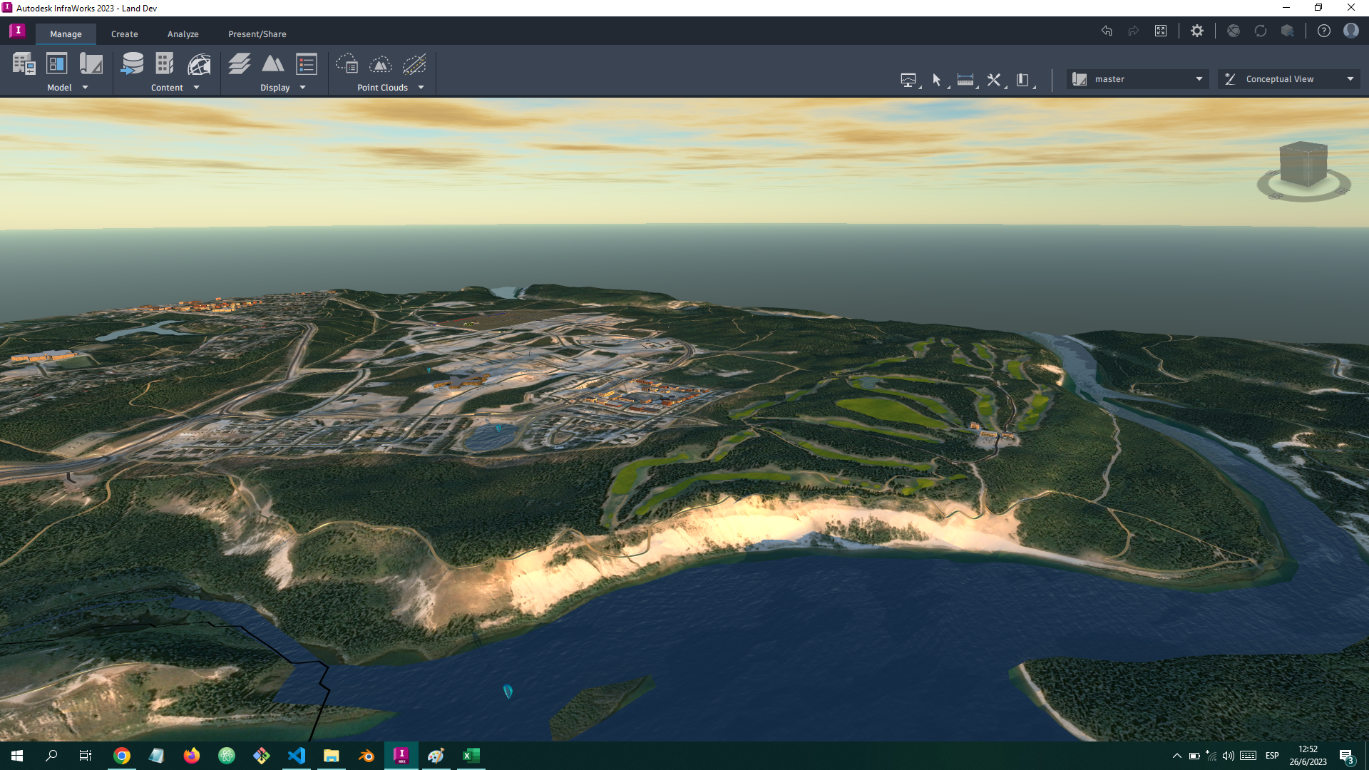
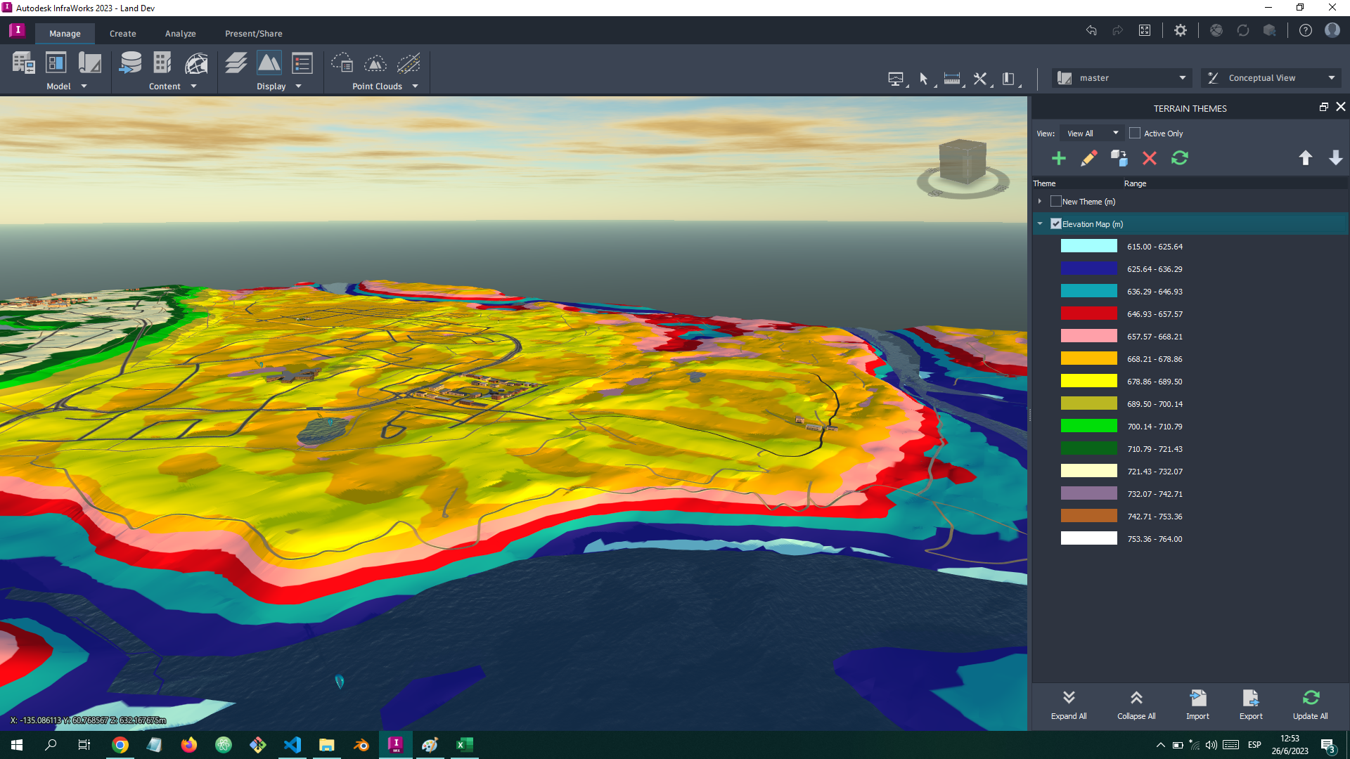
Terrain and elevation of the Whistle Bend project. Using GIS data and the built-in terrain feature I was able to create this base map of the area. This information allowed me to understand the area better. Whistle Bend involved a lot of earthwork to transform a huge area into a land development project. As an inspector I was able to learn a lot from this experience and then use the information gathered in the field to create this model of the site.

read more

Results & Reports

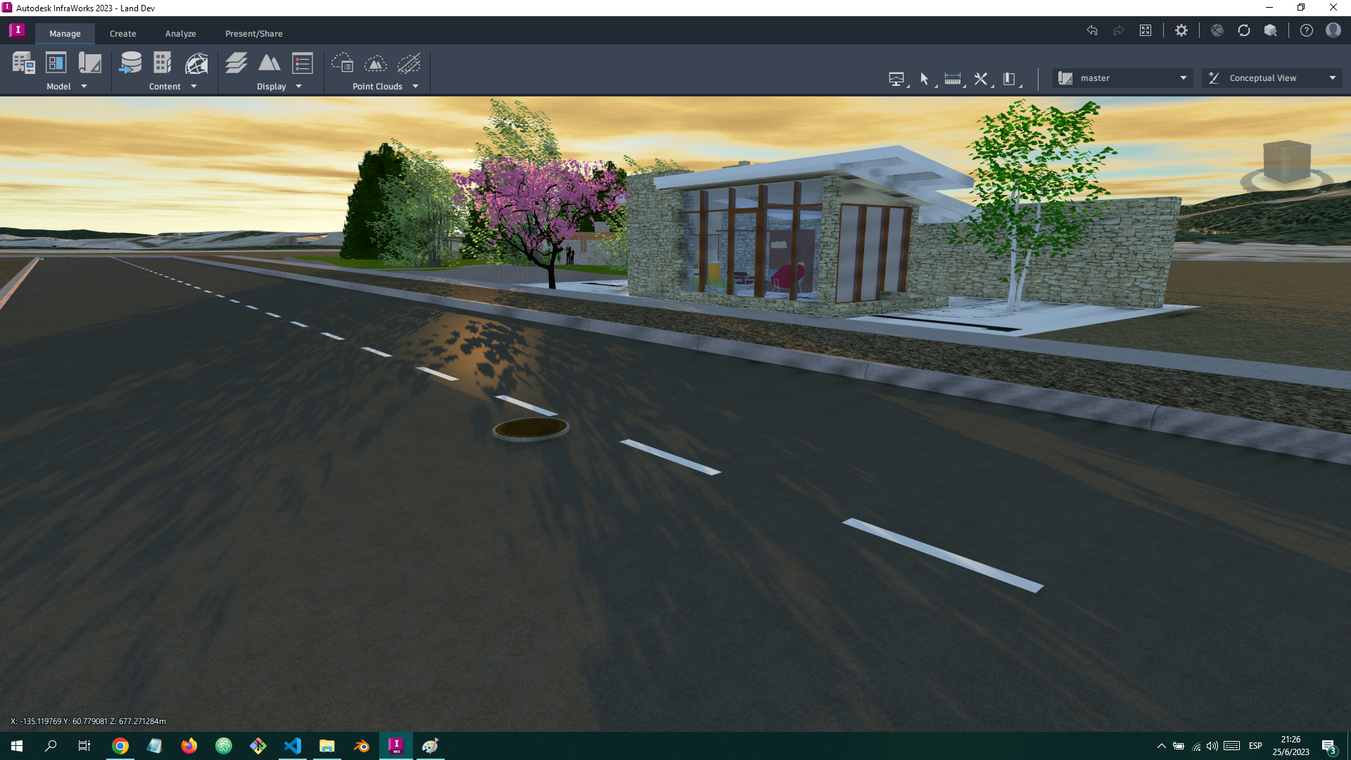
Closer look at the model

The view of a house inside one of the lots of Omega St. This house comes to life thanks to the magic of SketchUp

Take a Look

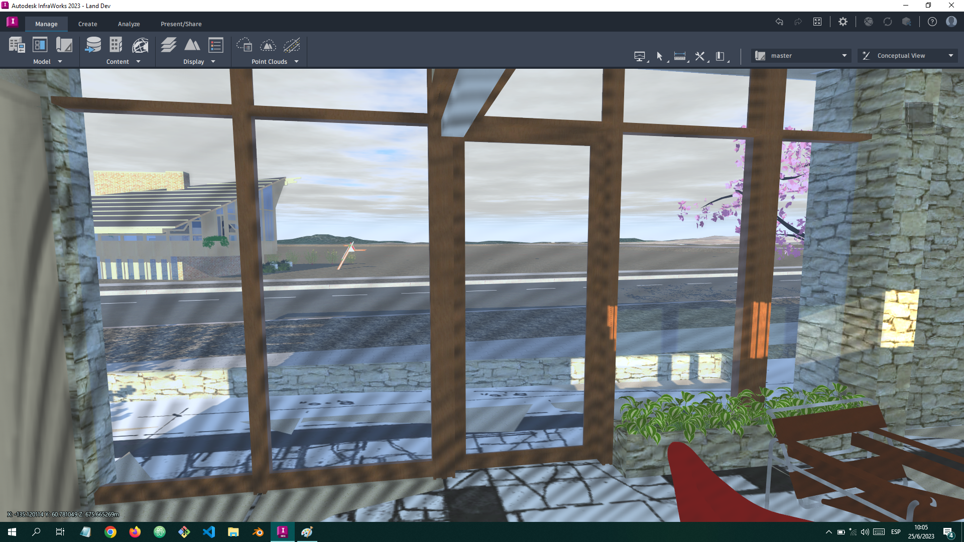
Inside the house

A look from inside one of the houses of the model towards Omega St.

Take A Look

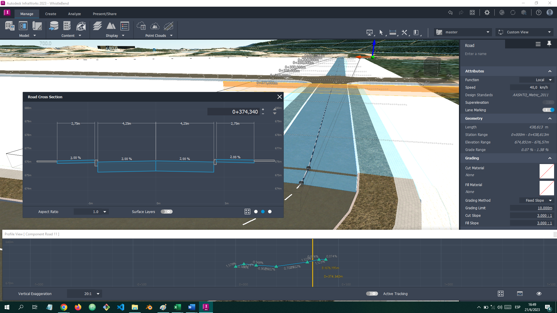
Cross Section

Cross section and profile view of Wyvern Ave.

Take A Look

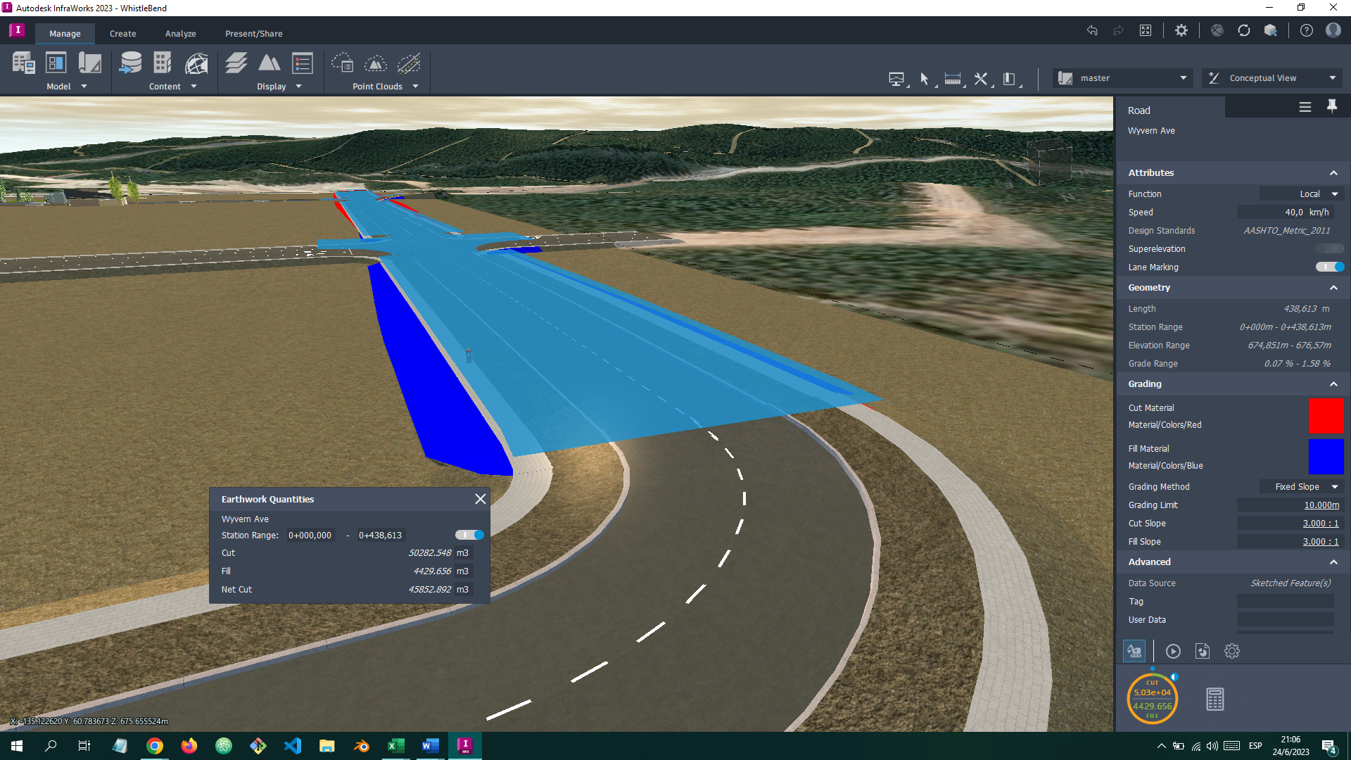
Cut and Fill

Cut and Fill estimation using the inbuilt cut and fill calculator.

Take A Look

Want to learn more about this study?